Boundaries, Utilities (Phones & Electricity), Roads & Transportation, Social Life, Homestead Act & More
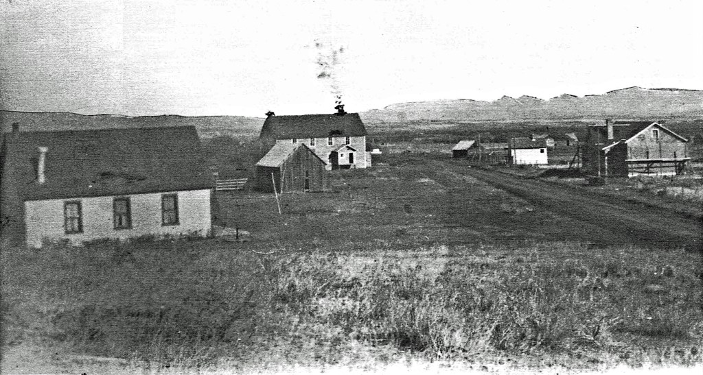
An Overall Look at Sedan by Kay Seitz (1962)
“Sedan is just a typical agricultural community, people work day in and day out doing the same thing, caring for their animals and looking after their ranches. They have a limited number of social functions, with the exception of a few people. The people are friendly and willing to help each other any time the need arises.“
“Few people in the community have a college education and there are even some without a high school education. This probably is the reason that less than 50% of the children attended college.“
“Sedan is a community within itself which I will always adore as the home where I grew up. It is beautiful, and holds so many memories of fun and good times that I can’t help but feel it about one of the nicest places in the world. Whether to spend ones’ life here is up to the individual. Myself I don’t think it offers me enough to ever live there, but I’ll always go to stay and spend my summers and vacations there. To appreciate Sedan, you have to know the people, and see the scenery.“
Boundaries Surrounding Sedan:
The following informal boundaries surrounding Sedan are listed in Grace Bates’ Book, Gallatin County Places and Things Past and Present accordingly: (North) Elkhorn Ridge – in the Bridger Mountain Range northeast of Flathead Pass, goes to the northeast corner of Gallatin County To, 4N R6, 7E
(South) Battle Ridge – elevation 6381, Section 32 T2N R7E (also listed as T4N R7E)
(East) Park County Line –
(West) Flathead Pass – elevation 6537, Indians used this pass to cross the Bridger Range. One of the main responsibilities of soldiers from Ft. Ellis was to insure the safety of the Gallatin Valley by guarding this pass from possible raids. Section 29 T3N R6E.
Sedan Area Creeks:
The ten small creeks which join to create Flathead Creek are: Frazier Creek, Ainger Creek, Carroll Creek (which is also noted on various maps as middle fork of Flathead and Kelly Creek), Cache Creek (thought to be named after Cashus M. Clay Morrison), Fairy Creek, South Fork of Flathead, Green Canyon Creek, Dry Creek, and Muddy Creek and North Fork Flathead Creek.
In Gallatin County Places Things Past and Present, Second Edition (Bates 1994), she offers the following information:
Cache Creek (Near Sedan) is north of Battle Ridge in Bridger Canyon. Joins Fairy Lake Creek Section 9 T2N R7E
Carrol Creek – Goes through Sedan into Flathead Creek Section 27 T3N R7E
Dry Creek – Goes into Park County T3N R7E
Fairy Lake Creek – Southwest of Sedan, comes from Fairy Lake, T1N R6, 7E. It joins Cache Creek at 9 T2N R7E then runs into Flathead Creek. Sec 27 T3N R7E
Flathead Creek – Has a north and a south fork, and goes into Park County Sec 25 T3N R7E
Frazier Creek – Has a north fork, joins Flathead Creek Sec 31 T3N R7E
Green Canyon Creek – (In Bridger Mountains) Section 12, 13 T2N R7E
Muddy Creek – It goes into Park County below Kister-Hardy Dam (Sec 1, 12 T3N) R7E. This creek has a North Fork, a Middle Fork, and a South Fork in Gallatin County.
North Fork Flathead Creek – Sec 32 T3N R7E
South Fork – goes into Flathead Creek T3 4N R5,6E
East Flathead Telephone Company (E.F.T.C.)
The first telephone company in the Sedan area was established in 1905, named the East Flathead Telephone Company. It served about 25 homes and ranches. According to their records, the first telephone was placed in the Herman Korde residence.* The Mountain States Telephone Company purchased East Flathead Telephone Company in 1929. No change was made in the service to Sedan until 1939, when dial telephones were installed in place of the magneto operation.
*”Tracks Volume I” states that “the Woosleys had the first telephone in the Sedan area. The phone made the connection between Bozeman and Wilsall. The phone was an old board phone with a crank on a side and two switches on top. If a call needed to get to Wilsall there was a switch that had to be closed and the same for the call to Bozeman. The Woosleys were sort of an operator service.”
Another account of how telephone came to Sedan is noted in the Sedan Community Country Cookbook, “They got the old magneto telephones strung over a good part of the valley. These were put up by the people themselves, but later the Inabnits took it over and added the extra lines and phones, and kept them working order. The Bell System bought them out later and put in their own lines.
The Ranger Station was also said to have had a phone in the early years.
Bonnie Pinkerton said, “The phone lines weren’t very good (our’s wasn’t that great, either) and sometimes people would come use our phone – especially for long distance. We received a bill one time with a call on it that we didn’t recognize and had no idea who may have made it. A month or so later one of the men from Sedan stopped in and told us he’d made a call one day when we were gone, so came to pay for it. Everyone was considered to be honest in those days unless proven otherwise and we all left our doors unlocked. I don’t remember the name of that man – wish I did.”
Electricity
The Sedan community acquired electricity in 1947, when the Park County Electric Coop put lines in. Kerosene lamps were used until that time. The cost of the electricity in this area was quite high, probably because the Co-op got their power from Montana Power Company. “Many people didn’t think they could afford electricity, even though the original price per 100 kilowatt hours was only $3.00, according to Virgil Isbell,” as noted in “Tracks Volume II.” This price was compared at $17.90 per 100 kilowatt hours as of Spring 1990.
In its earlier days Park County Electric Co-operative, Inc. in Livingston, known as REA (Rural Electrification Administration), established in 1935 by rural land owners to produce electricity for themselves and for their neighbors, as stated in “Tracks Volume II.” Also noted, “Before World War II, electric lines were built to Wilsall and up Flathead Creek to the Gallatin County line…The expansion of electricity came to a stop until after the war ended. Webb Brogan, as one of the directors, pushed after the war to get the lines finished…Power was turned on in the spring of 1948…The early construction of REA lines in the Shields was due largely to the efforts of Wesley D’Ewart, who came first as a ranger for Yellowstone County and then bought land on Flathead Creek. However, Webb Brogan was the man who probably put in the most time to get the rural area of Wilsall electrified.”
Also stated in Tracks Volume II, Spring 1990, “In the past year the poles that hold the lines up were replaced up Flathead Creek. The REA used a machine that dug the holes and set the poles in less than fifteen minutes. Virgil Isbell stated that when the first poles were set it took one man all day to dig and set one pole…most of that work was done primarily by hand.”
The Gold Mine
In or around 1910 there was a gold mine in the Sedan community. It was located up above the Alfred Wilson ranch about 6 miles southeast between Fraser and Fairy lakes. The only way to get to this mine now is to ride a horse as far as possible and then walk the remaining distance. It is a shaft mine, and as the story goes, at one time it produced quite a bit of gold. The only way supplies could be brought in was through the use of pack trains. During the winter the deep snow made it impossible to mine up there. The C.C.C. boys built a reservoir down from Fraser Lake and the trails that leads to the gold mine is about one mile below the reservoir. It is difficult to locate this mine unless one knows exactly where it is, since it is located on the very top of a mountain-hill. According to Kay Seitz, information was difficult to obtain on the mine, but it was believed to have been in operation only about one and one half years.
Jene Pergande Hendrickson said that Hattie Beckner and her Husband Bernard used to run sheep near the mine. Jene said that Hattie claims to have seen water coming out of some rocks nearby and figured it had something to do with the mining operation.
Dave Burrows, an Englishman, would not give up prospecting for gold at the above mentioned mine and lived in the mountains for years. Area residents wondered how he lived, because apparently no one in Sedan was aware of him ever striking gold. Some say he stole cattle for a living. He was 80 years old in 1932 and had been in the area a “mighty long time.” It was stated by Kay Seitz that, “You can’t say that Sedan didn’t have at least one loyal prospector.”
Sedan Area Lakes
In Gallatin County Places and Things Past and Present, Bates notes the following information:
Ainger Lake— North of Fairy Lake in the Bridger Mountains and was named for Fred E. Ainger, a ranger in the Gallatin Forest from 1906 to 1950. Section Township 2N Range 6E

Frazier Lake (also spelled Fraser below) – North of Fairy Lake in the Bridger Mountains Sec 15, T2N, R6E.
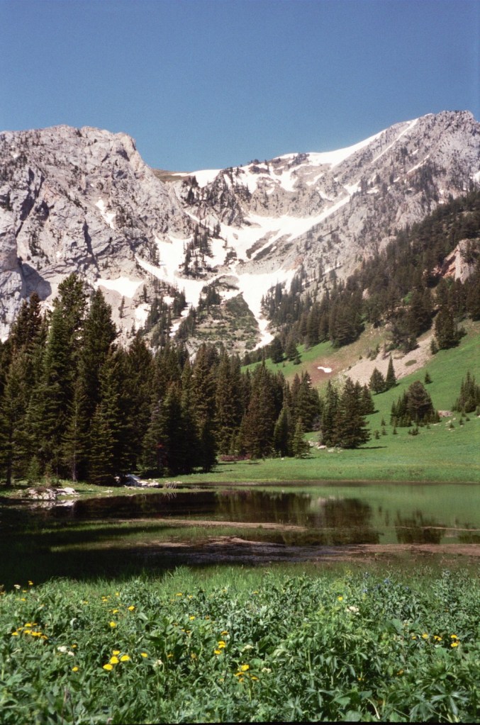
Kay Seitz shared the following on Frazier Lake, “As kids we used to ride up there every summer when we put the cattle out. After the cattle were up there Myrna and Robert Fastje, Greg and I and sometime others would take our lunches and ride up for the day.
The reservoir is the lower lake. This was built by the CCC Boys in the 1940s. It’s a pretty lake and is in a beautiful setting. The ‘real’ Fraser Lake is up above the CCC Boy’s lake. You have to climb up to this one. It’s truly beautiful and worth the climb. It sits in a little bowl in the mountains. You are alone with God here. It is so peaceful and quiet and untouched by humans.
If you climb up the south side of the mountains here you look right down upon Fairy Lake. This too, is a beautiful picture. This is country that still doesn’t have many people accessing it. The only way to get to Fraser Lake is by horseback and up to the real Fraser Lake is a steep climb. You can get up there in late, late June until the snow flies.”
Transportation
Horses were the primary means of transportation in the early days of Sedan and it took three days to travel to Bozeman before automobiles were used. Sedan residents were lucky if they made it to Bozeman as often as every two months. Supplies were normally obtained from Wilsall, and before Wilsall was founded, people bought supplies in Bozeman to last through the entire winter.
Even after the automobile was invented it was a long time before many people had cars in this area. The roads weren’t graveled until 1952 and still were not the best to drive cars over. Furthermore, the expense of cars led to them making a slow arrival to Sedan.
Sedan School students rode horseback to school most of the time. Up until 1957 horseback riders were Myrna and Robert Fastje, Kay and Greg Seitz, Lyle and Judy Woosley, Jim Francis, and Butch Waddell, who rode to school for 7 years.
Roads
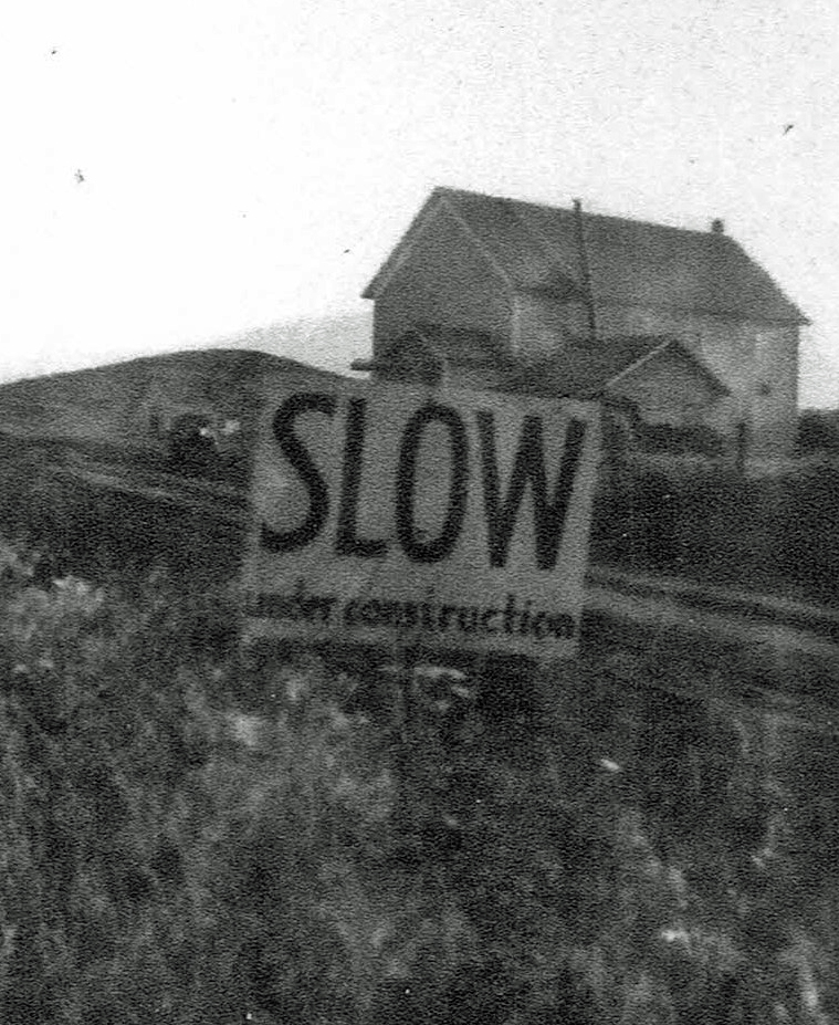
As shared by Eva Lachenmaier, Sedan School teacher in 1947, “The road from the Park County line to Wilsall was nicely graveled, but the Sedan people fought mud and snow most of the year. In 1947 George Stucky, a newly elected county commissioner, finally loaned an ear to Sedan’s plight and the county graveled the road with “pit run gravel,” boulders almost the size of footballs interspersed with smaller rocks and a bit of sand. Travel on these roads was no smooth going but the Sedan people were delighted. Now they could finally get to Wilsall and to their neighbors’ year round.”
Bonnie Pinkerton, Sedan resident in the late 1940s, had this to say, “Of course, Gallatin County did nothing with the road during the winter and people from around Sedan would come by team to our place, then we would take them on into Wilsall for groceries. One person would buy for all the surrounding neighbors so they wouldn’t all have to go to town. That was one of the worst winters (1949) I’ve ever seen!!!”
Battle Ridge Pass
Battle Ridge – (mountain pass between Sedan and Brackett Creek on the road to Bozeman). The story of how Battle Ridge got its name was retold in “Tracks Volume II” by Floyd V. Kenney of Livingston, “It was in the fall of 1902 when I was riding for Alfred Myers as he relates Myers’s version of the story regarding a “brush between Myer’s riders and a party of cattle-stealing Indians (in the 1870s between what were believed to have been Crows). The riders and some homesteaders took out after them. The Indians were about a half a mile south of the ridge when the shooting started. One of the cowboy’s horses was hit by Indian gunfire. The animal reared and bucked the rider to the ground. He broke his arm in the melee.
“Another of the cowboys got panicky. He stampeded his horse back to Myers’s camp on Flathead Creek. He spread the alarm that there were Indians as far as he could see. There must have been eight to a dozen Indians in the raiding party. The scared cowboy, after spreading the alarm at the range camp, rode on to the Gallatin, telling everyone about a large Indian war party. Myers took the rest of the cowboys and joined the fight on the ridge. The Indians had wisely withdrawn beyond the range of the white men’s 45-70 caliber rifles. Myers took a few shots at them with his 50 caliber which stirred up dust among them. The Indians decided to give up the fight. Nobody was killed.
“They took off down the river and crossed where the Ed Chaple ranch is now located. They ran onto a bunch of cows belonging to Myers. They killed nine of them, cut out their tongues and let the carcasses lay. The ridge is named after the incident. After killing the cattle, the Indian party continued on down the river to the lower Myers place. It was located where the Birch and Johnson ranch now is.
“It was dark and one of the Indians stuck his face flat against the window pane of the house. He almost scared Mrs. Sol P. Heron to death. She was a sister of the Myers brothers and came here from Missouri on a wagon with the late Mrs. Bill Officer. The Indians, however, didn’t do any damage at the ranch and continued on their way down the Shields River without incident.”
Flathead Pass Road – Before Flathead Pass road was graveled neighbors followed each other down the road to make sure the others made it or were forced to stay home all together when it rained. One time Lawrence Blattie followed Art Fastje all the way to the paved road at the county line. Art was driving a stock truck and Lawrence had a horse wagon and practically had to pull Art the whole way through the thick mud. As told by Helen Chriske, “If you were out and it had rained that day, you stayed out. If you were home, you stayed home.” A few times Helen’s children had to stay in Wilsall at school, because they couldn’t get home.
Flathead Pass Road was finally graveled between 1946 and 1948 with the help of the community. The county was always low on funds, so Art Fastje and Alfred Wilson were the head of a committee to ask neighbors for donations. Alfred, Art, and Ernest Chriske were the top donors as residents on the road. Gallatin County workers came over from Bozeman and were fed and put up by Grace Blattie, Helen Chriske, and Roberta Fastje.
Seitz Road According to “The Sedan Tour” published by the Park County Historical Society Seitz Road “seems to have been a main road. Some called it the “Back Road” others called it the “High Road.” Those who lived at the south end of the valley used it almost exclusively until much improvement was made on the main road. It went straight until it passed the Arnold Pergande place on Section 2 and then veered left to come out on the county line at a residence in line with Flathead Road and on into Shields or later Wilsall.”
Sacajawea 4-H Club
Sacajawea 4-H Club – The Sacajawea 4-H Club was organized in 1948, named after Lewis & Clark Expedition guide Sacajawea. There were ten members in the first club and leaders Mr. & Mrs. Roy Waddell and Mr. & Mrs. Lyle Reichman. In 1953 the leaders were Mrs. Stan Seitz and Mrs. Roy Waddell, it then had 15 members. In 1956, the club sent Nancy Francis to 4-H Congress and in 1960 Kay Seitz was named as one of the top ten members in the county. Past presidents were Bill Palmer, Jim Francis, Nancy Francis, Kay Seitz, Butch Waddell, Greg Seitz, and Bobby Christie.
The club cleaned the road sides and put up directional signs as one of their projects and won several prizes for the floats they entered in the Wilsall Rodeo. The club was one of the most active organizations in the community, but in 1961 the Sacajawea 4-H Club was disbanded due to lack of members. Virgil Isbell was a prominent leader of the club from 1956 to 1961.
Social Life
In the early times of Sedan dances were held above the Cheese Factory at least twice a month. See section on Cheese Factory for more detailed information.
In the early days of Sedan, residents were said to get together at each other’s home to play cards and visit. According to Hattie Beckner, former resident, they went by buggy in the summer and by sled in the winter. This visiting sometimes lasted until it was time to do the milking the next morning. To visit neighbors, people drove a team and sled or buggy, the bachelors rode horseback many miles. Sedan folks were noted as “a very sociable bunch.”
The Sedan Women’s club still meets once a month and community gatherings occur at the Sedan Community Center. The women of the club even put on a play at Cheese Factory dance hall.
The Ladies Card Club used to meet once a month to play “500”.
Frances (Orth) Inabnit, Sedan School teacher organized a “Social Center” upstairs in the Cheese Factory. At the first meeting each person was asked to tell where they had originally come from and how they got to Sedan.
At one Social Center gathering a plan was devised to lower the jack rabbit population. The men were divided into two groups and each would see how many rabbits they could kill. The losers would put on a dance and bring a jug of whiskey. One of the groups was said to have been stationed up a creek or at Green Canyon with shotguns. The others members of the group would “fan out and keep the rabbits ahead of them, funneling them toward the shooters. To keep count, they strung pairs of ears on twine. Some pictures were taken of these strings crisscrossed over the north side of the store, and barrels full of them.” The dance was believed to have been held in April. that year.
Sedan Rodeo
In the 1920s three acres of corrals were located where Bill and Becky Landis live now. These were used for rodeos for about three years. Josh Woosley’s son Walter had a red tag on a string which read, “Sedan Rodeo, September 3, 1923.” This is believed to be how rodeo tickets were sold at that time.
Doris Whithorn of Livingston has a picture of rodeo taking place there in her Photo History of Shields Valley.
The Oldest Ranch
The oldest and largest ranch in Sedan was started by Josh Woosley in 1884 or 1885 and been has handed down from generation to generation ever since. Joshua & Josie (Maddox) Woosley turned the operation over to Henry & Nina (Hunter) Woosley and they turned it over to Allen & Alta Woosley. Lyle & Myrt (Anderson) Woosley continue to run cattle on the expansive ranch today with the help of Tyler & Holley (Woosley) Vennes.
Sawmills
Josh Woosley owned a sawmill. It was noted that he sawed lumber for the “Williams home,” and the church. He donated the lumber for the church.
Homestead Act
The original Homestead Act was passed by Congress in 1862 with hopes of relieving industrial unrest, overcrowding, and unemployment in the east. The act limited homesteads to 160 acres, or a quarter section.
In 1877 the government sent a scientist, John Wesley Powell, director of the United States Geological Survey, out to investigate the western plains. He, and several others, took soil samples, made weather observations, studied the growth of native plants, and interviewed the early homesteaders. In his report to Congress, Powell recommended that the soil out here never be disturbed by a plow and that the standard land unit per family be increased to 2,560 acres, or 4 sections. He realized the land was best settled for raising cattle or sheep. He also advised that the homesteads not be laid out in squares, but in long rectangular areas that would cross at least one, and preferably more creek bottoms, so they would have water to go with the dry hills.
Congress paid no attention to this report, and the 160-acre law was not changed for 30 years. They even made matters worse by amending the laws, so that husband and wife count not file on separate homesteads, as they would by considered one person and not two.
In 1909 the Enlarged Homestead Act was passed giving an allotment of 320 acres per homestead, which was still not enough land to support a family. The new law required that at least 1/8 of the land be continuously cultivated for crops other than native grasses.
New Montana water rights laws were drawn up during the gold mining days and water was measured in minter’s inches instead of acre feet. There was no limit to the number of miner’s inches a person could file upon and some of the early homesteaders filed rights for as much as 500 inches of water when their creeks probably didn’t have that much in it! Water rights could be bought and sold. Rights established after 1900 are called “flood rights” and are only good during the spring run-off.
